Assessment of hail damages in maize using remote sensing and comparison with an insurance assessment: A case study in Lombardy
DOI:
https://doi.org/10.4081/ija.2022.2126Keywords:
Hailstorms, damage estimation, vegetation indices, modified soil-adjusted vegetation index, change detection.Abstract
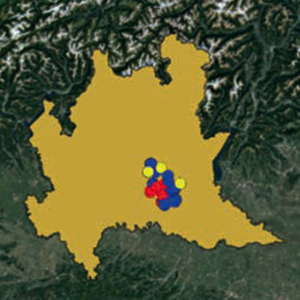
Studies have shown that the quantification of hail damage is generally inaccurate and is influenced by the experience of the field surveyors/technicians. To overcome this problem, the vegetation indices retrieved by remote sensing, can be used to get information about the hail damage. The aim of this work is the detection of medium-low damages (i.e., between 10 and 30% of the gross saleable production) using the much-used normalized difference vegetation index (NDVI) in comparison with alternative vegetation indices (i.e., ARVI, MCARI, SAVI, MSAVI, MSAVI2) and their change from pre-event to post-event in five hailstorms in Lombardy in 2018. Seventy-four overlapping scenes (10% cloud cover) were collected from the Sentinel-2 in the spring-summer period of 2018 in the Brescia district (Lombardy). An unsupervised classification was carried out to automatically identify the maize fields (grain and silage), testing the change detection approach by searching for damage by hail and strong wind in the Lombardy plain of Brescia. A database of 125 field surveys (average size 4 Ha) after the hailstorm collected from the insurance service allowed for the selection of the dates on which the event occurred and provided a proxy of the extent of the damage (in % of the decrease of the yield). Hail and strong wind damages ranged from 5 to 70%, and they were used for comparison with the satellite image change detection. The differences in the vegetation indices obtained by Sentinel 2 before and after the hailstorm and the insurance assessments of damage after the events were compared to assess the degree of concordance. The modified soil-adjusted vegetation index outperformed other vegetation indices in detecting hail-related damages with the highest accuracy (73.3%). On the other hand, the NDVI resulted in scarce performance ranking last of the six indices, with an accuracy of 65.3%. Future research will evaluate how much uncertainty can be found in the method’s limitations with vegetation indices derived from satellites, how much is due to errors in estimating damage to the ground, and how much is due to other causes.
Highlights
- The discovery rate of damaged fields improved.
- MSAVI outperformed NDVI and other vegetation indices, identifying 73.3% of occurrences.
- Estimation of damage from remote sensing was more accurate for fields severely affected >50%.
- In low-intensity hail events (<50 canopies affected), the MSAVI provided a detailed picture of the damage across the field.
- The proposed approach is promising to develop a ‘sampling map’ for detailed on-ground assessment.
Downloads
References
Abendroth LJ, Elmore RW, Boyer MJ, Marlay SK, 2011. Corn growth and development. PMR 1009. Iowa State University Extension, Ames, IA, USA.
Adee EA, Paul LE, Nafziger ED, Bollero GA, 2005. Yield loss of corn hybrids to incremental defoliation. Online. Crop Manage. 4:1-9.
Adnan M, Fahad S, Zamin M, Shah S, Mian IA, Danish S, Zafar-ul-Hye M, Battaglia ML, Naz RMM, Saeed B, Saud S, Ahmad I, Yue Z, Brtnicky M, Holatko J, Datta R, 2020. Coupling phosphate-solubilizing bacteria with phosphorus supplements improve maize phosphorus acquisition and growth under lime induced salinity stress. Plants 9:900.
Andrade FH, Vega C, Uhart S, Cirilo A, Cantarero M, Valentinuz O, 1999. Kernel number determination in maize. Crop Sci. 39:453-9.
Azzari G, Jain M, Lobell DB, 2017. Towards fine resolution global maps of crop yields: testing multiple methods and satellites in three countries. Remote Sens. Environ. 202:129-41.
Battaglia M, Lee C, Thomason W, Van Mullekom J, 2019. Effects of corn row width and defoliation timing and intensity on canopy light interception. Crop Sci. 59:1718-31.
Berti A, Maucieri C, Bonamano A, Borin M, 2019. Short-term climate change effects on maize phenological phases in northeast Italy. Ital. J. Agron. 14:222-9.
Botzen WJW, Bouwer LM, van den Bergh JCJM, 2010. Climate change and hailstorm damage: Empirical evidence and implications for agriculture and insurance. Resour. Energy Econ. 32:341-62.
Capitanio F, De Pin A, 2018. Measures of efficiency of agricultural insurance in Italy, Economic evaluations. Risks 6:126.
Childs SJ, Schumacher RS, Demuth JL, 2020. Agricultural perspectives on hailstorm severity, vulnerability, and risk messaging in Eastern Colorado. Weather Clim. Soc. 12:897-911.
Congalton RG, 1991. A review of assessing the accuracy of classifications of remotely sensed data. Remote Sens. Environ. 37:35-46.
Curry GN, Koczberski G, 2012. Relational economies, social embeddedness and valuing labour in agrarian change: an example from the developing world. Geogr. Res. 50:377-92.
Drusch M, Del Bello U, Carlier S, Colin O, Fernandez V, Gascon F, Hoersch B, Isola C, Laberinti P, Martimort P, Meygret A, Spoto F, Sy O, Marchese F, Bargellini P, 2012. Sentinel-2: ESA’s optical high-resolution mission for GMES operational services. Remote Sens. Environ. 120:25-36.
Erhardt R, Bell J, Blanton B, Nutter F, Robinson M, Smith R, 2019. Stronger climate resilience with insurance. Bull. Am. Meteorol. Soc. 100:1549-52.
Erickson BJ, Johannsen CJ, Vorst JJ, Biehl LL, 2004. Using remote sensing to assess stand loss and defoliation in maize. Photogramm. Eng. Remote Sens. 70:717-22.
EUROSTAT, 2021. Statistics | Eurostat. In: Crop Prod. Available from: https://ec.europa.eu/eurostat/databrowser/view/APRO_CPNH1__custom_1271804/default/line?lang=en Accessed: 8 September 2021.
Fabijańczyk P, Zawadzki J, 2022. Spatial correlations of NDVI and MSAVI2 indices of green and forested areas of urban agglomeration, case study Warsaw, Poland. Remote Sens. Appl. Soc. Environ. 26:2352-9385.
Fadaei H, 2020. Advanced land observing satellite data to identify ground vegetation in a juniper forest, northeast Iran. J. For. Res. 31:531-9.
Furlanetto J, Ferro ND, Briffaut F, Carotta L, Polese R, Dramis A, Miele C, Persichetti A, Nicoli L, Morari F, 2021. Mapping of hailstorm and strong wind damaged crop areas using LAI estimated from multispectral imagery. In: Precision agriculture ‘21. Wageningen Academic Publishers, The Netherlands, pp 315-321.
Gallo K, Schumacher P, Boustead J, Ferguson A, 2019. Validation of satellite observations of storm damage to cropland with digital photographs. Weather Forecast 34:435-46.
Gaupp F, Pflug G, Hochrainer-Stigler S, Hall J, Dadson S, 2017. Dependency of crop production between global breadbaskets: a copula approach for the assessment of global and regional risk pools. Risk Anal. 37:2212-28.
Gobbo S, Ghiraldini A, Dramis A, Dal Ferro N, Morari F, 2021. Estimation of hail damage using crop models and remote sensing. Remote Sens. 13:2655.
Grotjahn R, 2021. Weather extremes that affect various agricultural commodities. In: Extreme Events and Climate Change. Wiley, pp 21-48
Hamar D, Ferencz C, Lichtenberger J, Tarcsai G, Ferencz-Árkos I, 1996. Yield estimation for corn and wheat in the Hungarian Great Plain using Landsat MSS data. Int. J. Remote Sens. 17:1689-99.
Hatfield JL, Gitelson AA, Schepers JS, Walthall CL, 2008. Application of spectral remote sensing for agronomic decisions. Agron. J. 100:0370c.
Hov Ø, Cubasch U, Fischer E, Höppe P, Iversen T, Kvamstø NG, Kundzewicz ZW, Rezacova D, Rios D, Duarte Santos F, Schädler B, Veisz O, Zerefos C, Benestad R, Murlis J, Donat M, Leckebusch GC, Ulbrich U, 2013. Extreme weather events in Europe: preparing for climate change adaptation. Report produced by Norwegian Meteorological Institute in cooperation with EASAC. Available from: http://www.easac.eu/fileadmin/PDF_s/reports_statements/Extreme_Weather/Extreme_Weather_full_version_EASAC-EWWG_final_low_resolution_Oct_2013f.pdf
Johnson RR, 1978. Growth and yield of maize as affected by early‐season defoliation 1. Agron. J. 70:995-8.
Lauer JG, Roth GW, Bertram MG, 2004. Impact of defoliation on corn forage yield. Agron. J. 96:1459-63.
Leo S, Migliorati MDA, Grace PR, 2021. Predicting within-field cotton yields using publicly available datasets and machine learning. Agron. J. 113:1150-63.
Lesk C, Rowhani P, Ramankutty N, 2016. Influence of extreme weather disasters on global crop production. Nature 529:84-87.
Link J, Graeff S, Batchelor WD, Claupein W, 2006. Evaluating the economic and environmental impact of environmental compensation payment policy under uniform and variable-rate nitrogen management. Agric. Syst. 91:135-53.
Lobell DB, Azzari G, 2017. Satellite detection of rising maize yield heterogeneity in the U.S. Midwest. Environ. Res. Lett. 12:014014.
Lopresti MF, Di Bella CM, Degioanni AJ, 2015. Relationship between MODIS-NDVI data and wheat yield: a case study in Northern Buenos Aires province, Argentina. Inf. Process Agric. 2:73-84.
Lyubchich V, Newlands NK, Ghahari A, Mahdi T, Gel YR, 2019. Insurance risk assessment in the face of climate change: Integrating data science and statistics. WIREs Comput. Stat. 11:1462.
Ma Z, Liu Z, Zhao Y, Zhang L, Liu D, Ren T, Zhang X, Li S, 2020. An unsupervised crop classification method based on principal components isometric binning. ISPRS Int. J. Geo-Inf. 9:648.
Meier U, Bleiholder H, Buhr L, Feller C, Hack H, Heß M, Lancashire PD, Schnock U, Stauß R, van den Boom T, Weber E, Zwerger P, Peter Zwerger C, 2009. Das BBCH-System zur Codierung der phänologischen Entwicklungsstadien von Pflanzen - Geschichte und Veröffentlichungen. J. Kult. 61:41-52.
Molthan AL, Schultz LA, McGrath KM, Burks JE, Camp JP, Angle, K, Bell JR, Jedlovec GJ, 2020. Incorporation and use of earth remote sensing imagery within the NOAA/NWS damage assessment toolkit. Bull. Am. Meteorol. Soc. 101:E323-40.
Nguy-Robertson A, Gitelson A, Peng Y, Viña A, Arkebauer T, Rundquist D, 2012. Green leaf area index estimation in maize and soybean: combining vegetation indices to achieve maximal sensitivity. Agron. J. 104:1336-47.
Nutini F, Confalonieri R, Paleari L, Pepe M, Criscuolo L, Porta F, Ranghetti L, Busetto L, Boschetti M, 2021. Supporting operational site-specific fertilization in rice cropping systems with infield smartphone measurements and Sentinel-2 observations. Precis. Agric. 1-20.
Österreichische Hagelversicherung, 2013. Österreichische Hagelversicherung, 27. Dezember 2013. In: Österreichische Hagelversicherung. Available from: https://www.hagel.at/
Peralta N, Assefa Y, Du J, Barden C, Ciampitti I, 2016. Mid-season high-resolution satellite imagery for forecasting site-specific corn yield. Remote Sens. 8:848.
Prabhakar M, Gopinath KA, Reddy AGK, Thirupathi M, Rao CS, 2019. Mapping hailstorm damaged crop area using multispectral satellite data. Egypt J. Remote Sens. Sp. Sci. 22:73-9.
Schillaci C, Tadiello T, Acutis M, Perego A, 2021. Reducing topdressing N fertilization with variable rates does not reduce maize yield. Sustain 13:8059.
Shah A, Agarwal R, Baranidharan B, 2021. Crop yield prediction using remote sensing and meteorological data. Proc. Int. Conf. Artif. Intell. Smart Syst. ICAIS 2021:952-60.
Sibley AM, Grassini P, Thomas NE, Cassman KG, Lobell DB, 2014. Testing remote sensing approaches for assessing yield variability among maize fields. Agron. J. 106:24-32.
Sosa L, Justel A, Molina Í, 2021. Detection of crop hail damage with a machine learning algorithm using time series of remote sensing data. Agronomy 11:2078.
Szantoi Z, Geller GN, Tsendbazar NE, See L, Griffiths P, Fritz S, Gong P, Herold M, Mora B, Obregón A, 2020. Addressing the need for improved land cover map products for policy support. Environ. Sci. Policy 112:28-35.
Talukdar G, Sarma AK, Bhattacharjya RK, 2020. Mapping agricultural activities and their temporal variations in the riverine ecosystem of the Brahmaputra River using geospatial techniques. Remote Sens. Appl. Soc. Environ. 20:100423.
Toeglhofer C, Mestel R, Prettenthaler F, 2012. Weather value at risk: on the measurement of noncatastrophic weather risk. Weather Clim. Soc. 4:190-9.
Toreti A, Cronie O, Zampieri M, 2019. Concurrent climate extremes in the key wheat producing regions of the world. Sci. Rep. 9:5493.
Verrelst J, Rivera JP, Moreno J, Camps-Valls G, 2013. Gaussian processes uncertainty estimates in experimental Sentinel-2 LAI and leaf chlorophyll content retrieval. ISPRS J. Photogramm. Remote Sens. 86:157-67.
Verrelst J, Rivera JP, Veroustraete F, Muñoz-Marí J, Clevers JGPW, Camps-Valls G, Moreno J, 2015. Experimental Sentinel-2 LAI estimation using parametric, non-parametric and physical retrieval methods - A comparison. ISPRS J. Photogramm. Remote Sens. 108:260-72.
Vescovo L, Gianelle D, Dalponte M, Miglietta F, Carotenuto F, Torresan C, 2016. Hail defoliation assessment in corn (Zea mays L.) using airborne LiDAR. F. Crop Res. 196:426-37.
Vroege W, Finger R, 2020. Insuring weather risks in european agriculture. EuroChoices 19:54-62.
Vuolo F, Neuwirth M, Immitzer M, Atzberger C, Ng WT, 2018. How much does multi-temporal Sentinel-2 data improve crop type classification? Int. J. Appl. Earth Obs. Geoinf. 72:122-30.
Vyas S, Dalhaus T, Kropff M, Aggarwal P, Meuwissen MPM, 2021. Mapping global research on agricultural insurance. Environ Res Lett. 16:103003.
Wang J, Ding J, Yu D, Ma X, Zhang Z, Ge X, Teng D, Li X, Liang J, Lizaga I, Chen X, Yuan L, Guo Y, 2019. Capability of Sentinel-2 MSI data for monitoring and mapping of soil salinity in dry and wet seasons in the Ebinur Lake region, Xinjiang, China. Geoderma 353:172-87.
Xiong J, Thenkabail PS, Gumma MK, Teluguntla P, Poehnelt J, Congalton RG, Yadav K, Thau D, 2017. Automated cropland mapping of continental Africa using Google Earth Engine cloud computing. ISPRS J Photogramm. Remote Sens. 126:225-44.
Published
How to Cite
Issue
Section
License
Copyright (c) 2022 The Author(s)

This work is licensed under a Creative Commons Attribution-NonCommercial 4.0 International License.
PAGEPress has chosen to apply the Creative Commons Attribution NonCommercial 4.0 International License (CC BY-NC 4.0) to all manuscripts to be published.
